Location guide
Japan Skiing Locations Guide
My concise, map-first guide to skiing Japan: Hokkaido, Honshu, Tohoku, useful resort maps, and the notes I actually use when planning trips.
This is my working Japan skiing map.
Not a complete encyclopedia. Not a generic ski packing blog. Just the maps, routes, and notes I wish I had when I first tried to understand where to ski in Japan.
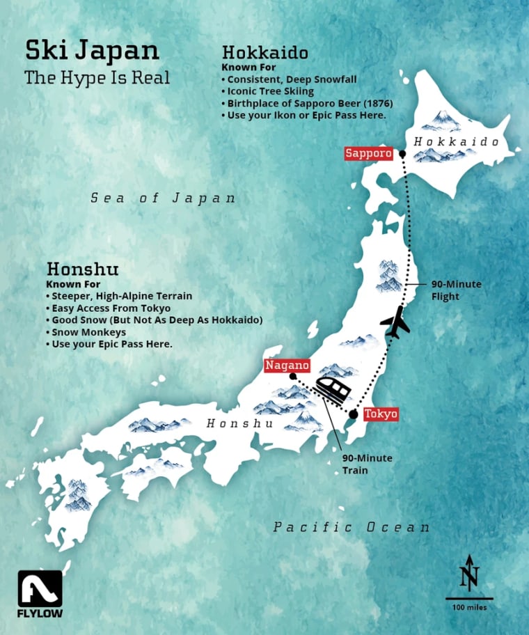
The useful split:
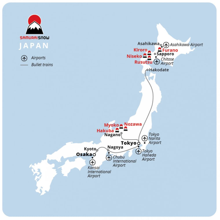
- Hokkaido: colder, deeper, generally less steep. Niseko, Rusutsu, Furano, Kiroro.
- Honshu: bigger mountain feel, steeper terrain, easier Tokyo pairing. Hakuba, Myoko, Nozawa, Shiga Kogen.
- Tohoku: technically northern Honshu, but I think of it as its own layer. More spread out, less polished, very good for storm chasing.
If you only remember one thing: choose a region first. Japan has hundreds of ski areas, but the trip becomes much easier once you know which part of the country you are actually trying to ski.
Start Here
| If You Want | Start With | My Note |
|---|---|---|
| Easiest first Japan ski trip | Niseko | Most international, easiest logistics, lots of English support. Not hidden. Still useful. |
| Best Honshu all-rounder | Hakuba | Big valley, lots of options, more mountain feel. Get a car if you can. |
| Hokkaido sampler | Kiroro -> Niseko -> Rusutsu -> Furano | This is basically what I did in 2024. Good trip, big transfer days. |
| Traditional ski town | Nozawa Onsen | Village, onsens, restaurants, skiing. Can be crowded, still special. |
| More local Honshu feel | Myoko Kogen | Akakura Onsen is the main base. Less polished, more Japanese. |
| Connected mega area | Shiga Kogen | Unlike Hakuba, you can ski between many of the areas. |
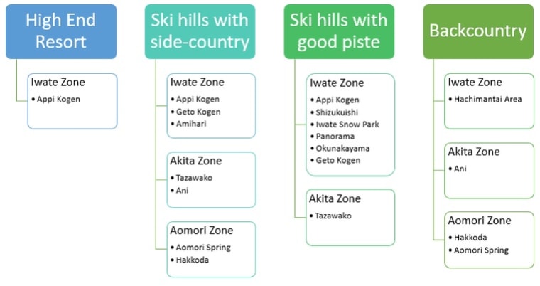
| Tohoku storm chasing | Zao, Appi, Geto, Hakkoda | More effort. More interesting once you understand the basics. |
My Trips
The value in this guide is not that I found every resort on Google. It is that I keep using these maps to plan actual trips.
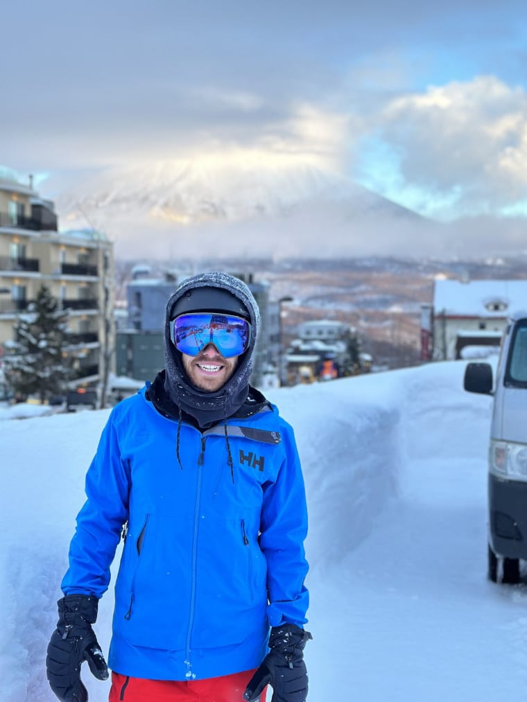
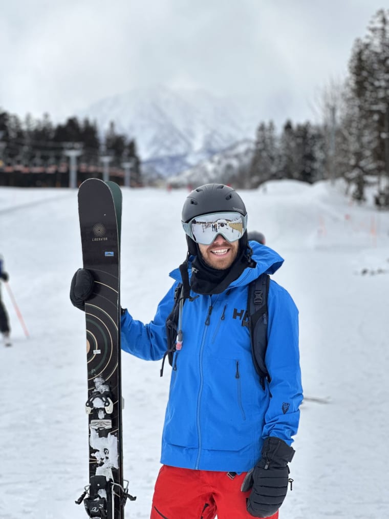
2024
Hokkaido sampler into Hakuba
- Tokyo
- Sapporo
- Kiroro
- Niseko
- Rusutsu
- Furano
- Hakuba
This trip made the Hokkaido/Honshu split real for me. Good route, huge transfer days.
2025
Honshu, including Nozawa
- Honshu
- Nozawa
I still need to add the exact day-by-day notes, so I am keeping this deliberately loose for now.
2026
Tohoku by train towns and shuttles
- Tokyo
- Yamagata
- Zao
- Morioka
- Appi
- Kitakami
- Geto
This made Tohoku click: train cities, shuttles, resort hotels, and separate snow zones.
2023: first Japan ski notes and photos. The itinerary is incomplete, so I am not pretending it is route advice yet.
My strongest practical note so far: get a car when the trip depends on choice. Hakuba shuttles can fill. Hokkaido is better when you can move. Tohoku is much easier if you can chase the day instead of being trapped by a timetable.
Orientation Maps
First, the simple geography.
Hokkaido is the northern island. Honshu is the main island. Tokyo, Nagano, Niigata, Tohoku, and most of the rest of Japan sit on Honshu.
I also keep this interactive map around because it is one of the fastest ways to get your bearings:
Open the interactive Japan skiing map
Useful map links:
- OpenSkiMap - best broad ski map.
- SkiMap.org Japan
- SamuraiSnow Japan ski resorts
Trip Rules
These are the planning notes I actually keep coming back to.
- Choose the region first: Hokkaido, Honshu, or Tohoku.
- Get a car when choice matters: Hakuba, Hokkaido road-tripping, Tohoku storm chasing.
- Do not hide transfer days from yourself: my 2024 Furano -> Hakuba day was drive to Sapporo, fly to Tokyo, shuttle to Hakuba, arrive late.
- Tohoku is shuttle logistics: in 2026 I planned it around Yamagata/Zao, Morioka/Appi, and Kitakami/Geto.
Hokkaido
Hokkaido is the classic powder island: colder, deeper, usually less steep.

My 2024 Hokkaido shape:
- Fly Tokyo -> Sapporo.
- Drive early to Kiroro.
- Stay around Niseko.
- Ski Niseko for a few days.
- Ski Rusutsu.
- Drive to Furano.
- Ski Furano, then do the big transfer to Hakuba.
Niseko
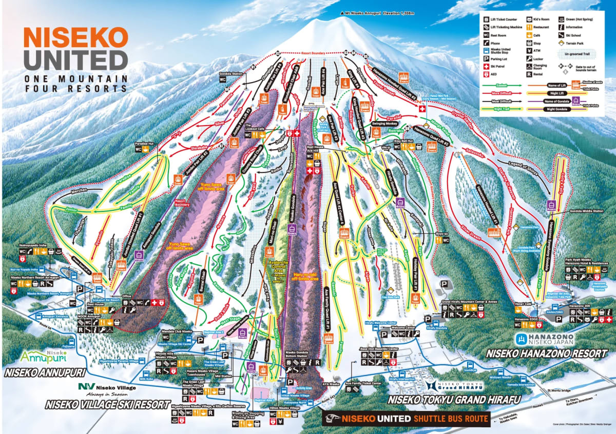
Niseko is the famous one. It is not hidden. It is still the easiest place to start.
- Four connected base areas: Annupuri, Niseko Village, Grand Hirafu, Hanazono.
- Grand Hirafu is the main hub: restaurants, hotels, nightlife.
- Annupuri is good for beginners and usually calmer.
- Hirafu has lots of night skiing.
- Best map of slopes and towns: SamuraiSnow Niseko maps.
Niseko Moiwa

- Moiwa is around the corner from Niseko United.
- It is not connected.
- The reject mountain. Nearby, separate, easy to forget.
Niseko Gates
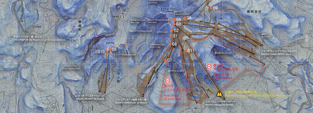
The gates are part of why Niseko is interesting. They are also not normal resort skiing.
Rusutsu
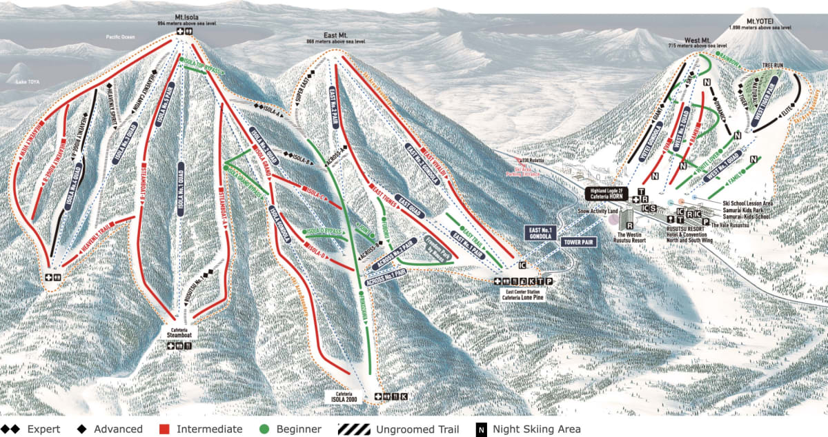
Rusutsu is close to Niseko but feels less town-based.
- Better powder-to-crowd ratio than Niseko.
- Good tree skiing.
- More resort than village.
- Works well with a car.
- Best map: SamuraiSnow Rusutsu maps.
- Official map: Rusutsu trail map.
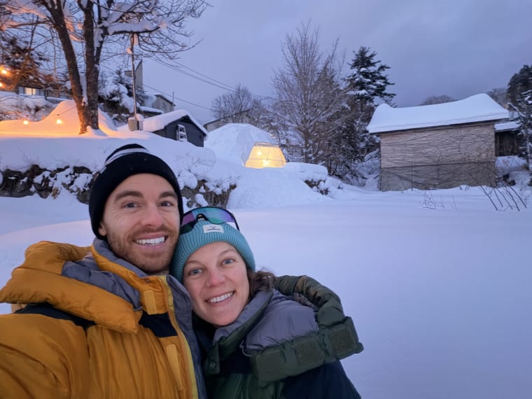
Andrew and Annie stayed at Lake Toya, about 30 minutes away, in an Airbnb. That is a good reminder: Rusutsu does not have to be a single-resort bubble.
Furano

Furano is the calmer central Hokkaido base.
- More local feel than Niseko.
- Good terrain without the same international resort feeling.
- Useful base for central Hokkaido.
- Ski and village maps: SamuraiSnow Furano maps.
Andrew and Annie stayed at Chalet Burlap Furanui and said it was close to the hill.
Kiroro

- Around one hour from Sapporo.
- Useful first ski day if you fly into Sapporo and have a car.
- Map: SamuraiSnow Kiroro maps.
Asahidake And Kurodake
These are not normal resort days.
- Asahidake: one ropeway, active volcano, Daisetsuzan National Park, minimal facilities. Hire a guide and plan around weather.
- Kurodake: another Daisetsuzan objective. The note says “hike the peak and ride all the way back to the road”, which sounds epic and also like exactly the kind of sentence that should make you hire a guide.
Honshu
Honshu is the main island. For skiing, the useful first layer is Nagano/Niigata: Hakuba, Myoko, Nozawa, Madarao, Shiga Kogen, Lotte Arai.
Hokkaido is “deep not steep”. Honshu is steeper, bigger-feeling, and logistically messier.
Hakuba Valley
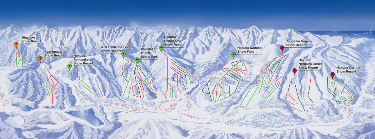
The most important Hakuba fact: Hakuba Valley is not one connected resort.
It is a valley of separate ski areas. From one end to the other is roughly 30 minutes by car.
Useful maps:
Hakuba Ski Areas
- Happo-One: biggest, most famous.
- Hakuba 47 + Goryu: combined ticket, good first Hakuba day if conditions are not screaming Cortina.
- Iwatake
- Tsugaike Kogen
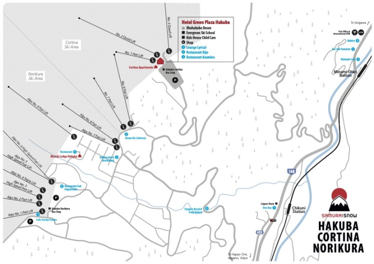
- Hakuba Norikura
- Hakuba Cortina
Powder-day order from the notes:
- Cortina: north end of the valley, best powder day reputation. Everyone knows this.
- Norikura
- Tsugaike
Cortina can get three times more snow than Happo-One on the right storm.
Happo-One

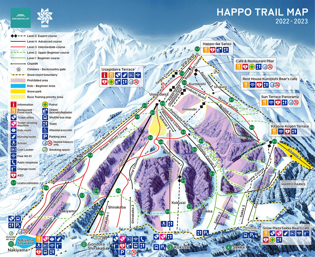
Off-piste notes:
- Ridge skier’s left of the Alpen quad: high, good snow, gets tracked quickly.
- Omusubi-adjacent terrain is another known area.
- Shirakaba trees need good snow quality because they are lower.
Cortina / Norikura
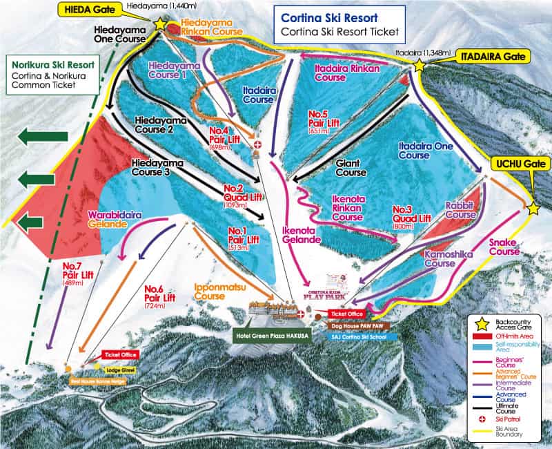

- Cortina is the powder-day magnet.
- Norikura belongs in the same decision tree.
- If Cortina is obvious, crowded, or already tracked, look at Norikura.
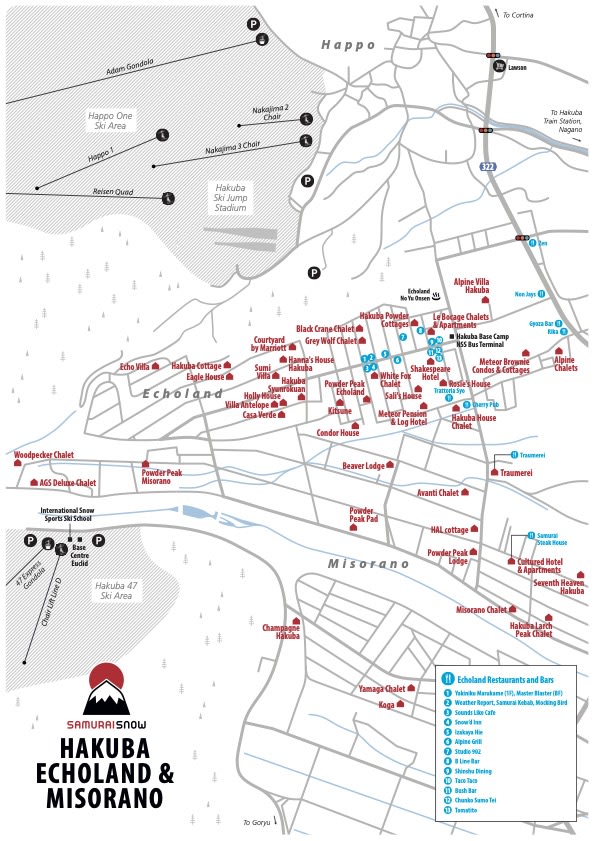
Hakuba Towns
Where you sleep changes the trip.
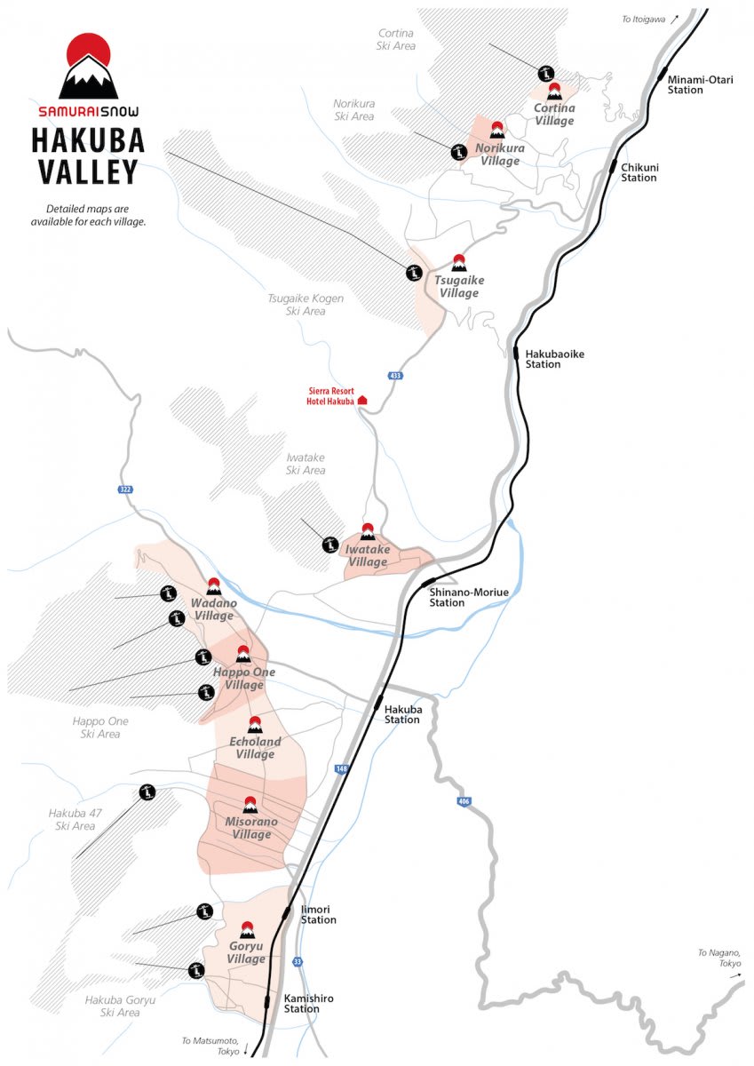

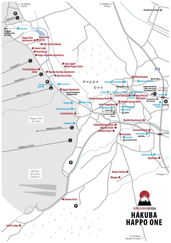
- Wadano / Happo: convenient for Happo-One.
- Echoland: restaurants and nightlife.
- Cortina / Norikura: better for northern powder days, worse for central valley dinners.
My 2024 note: the Hokkaido -> Hakuba transfer was a huge day. Drive to Sapporo, fly to Tokyo, shuttle to Hakuba, arrive late. It worked, but I would not casually recommend stacking too many days like that.
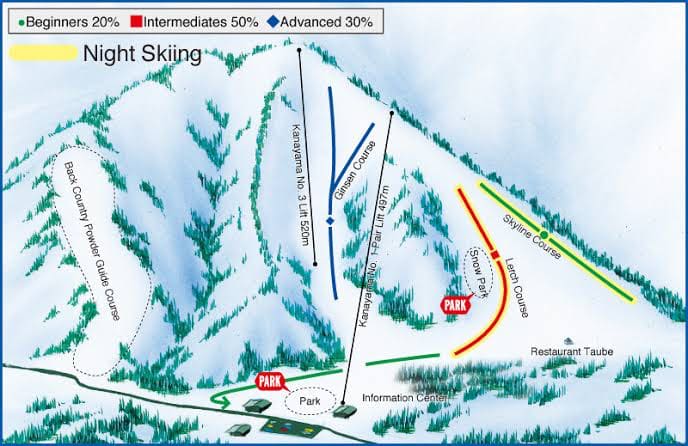
Myoko Kogen

Myoko is a group of ski areas near Nagano/Niigata. Akakura Onsen is the main base.
- More Japanese-feeling than Niseko/Hakuba.
- Serious snow.
- Less polished.
- Good if you want a local-feeling Honshu trip.
Useful links:
Myoko Area Maps
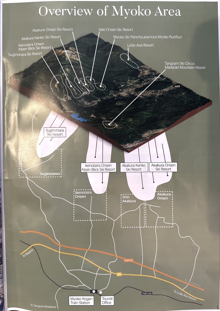


Myoko Notes
- Akakura Kanko: core Myoko ski area.
- Suginohara: part of the broader Myoko decision set.
- Seki: storm-chasing / local-knowledge category.
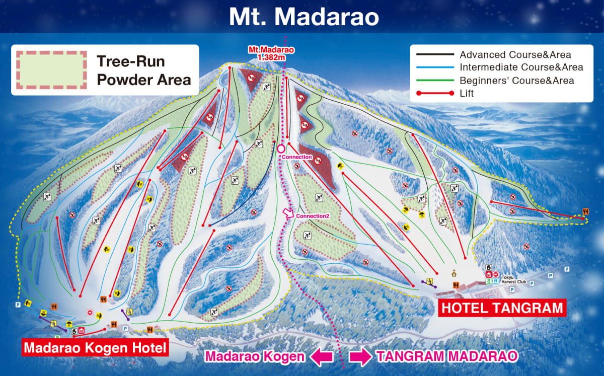
- Madarao: off-piste is permitted in a way you cannot assume elsewhere in Japan. Around 60% ungroomed.
- Lotte Arai: major Myoko/Niigata-area option.

Nozawa Onsen
Nozawa is a real village with a ski resort attached. That is the appeal.

- Traditional onsen village.
- Proper town texture.
- Great upper-mountain powder zones.
- Can be crowded with both locals and travelers.
- Best snow days are usually late January / early February.
Powder note:
- Yamabiko Area is the top section for powder and tree runs.
Useful links:
Town notes:
- Restaurant/bar map: SamuraiSnow Nozawa restaurants and bars map
- Totarina
- Jiyu Gekijo
- Paid onsen: Furusato no Yu
Togari Onsen
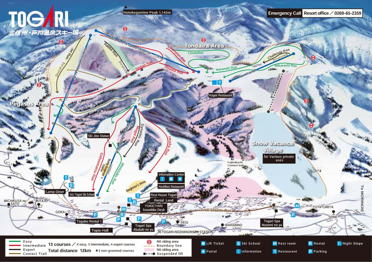
- Small resort near Nozawa.
- Good powder.
- Fewer crowds.
- Useful Nozawa-area alternative.
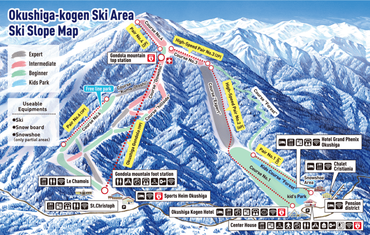
Shiga Kogen
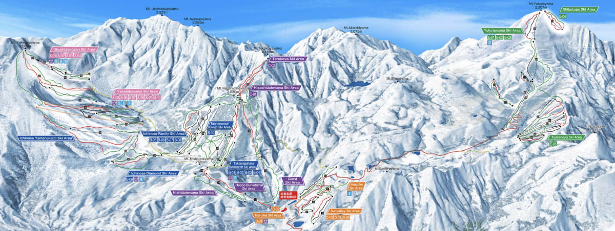

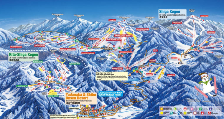
Shiga Kogen is one of Japan’s largest ski areas.
The key difference:
- Hakuba = separate resorts spread along a valley.
- Shiga Kogen = many areas are interconnected, so you can ski between them.
Areas to know:
- Ichinose: central area.
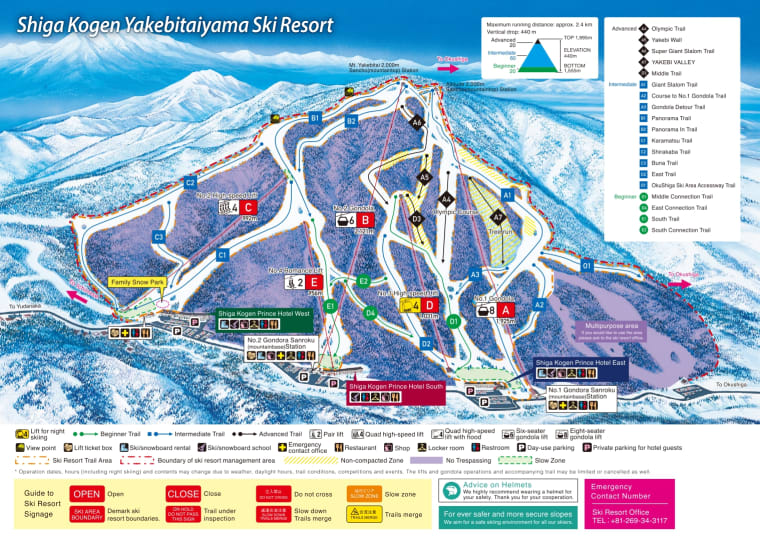
- Yakebitaiyama: 1998 Olympics venue, higher area.
- Okushiga: highly recommended; furthest point of connected Shiga; key sidecountry/backcountry area.
- Kumanoyu: bus needed.
- Yamanoeki: gateway bus station.

Useful links:
- Shiga Kogen trail map
- Snow Monkey Resorts Shiga Kogen guide
- Shiga Kogen sidecountry PDF
- Mountainwatch guide to Shiga Kogen
Tohoku
Tohoku is the northern region of Honshu.
I think of it separately because the trip style is different: train cities, shuttles, spread-out resorts, less polish, more storm-chasing.
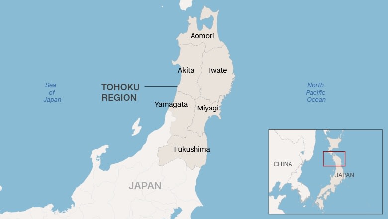
Prefectures:
- Aomori
- Akita
- Iwate
- Yamagata
- Miyagi
- Fukushima

The useful city bases:
- Morioka: Appi Kogen, Hachimantai/Shimokura, Shizukuishi, Tazawako, Geto Kogen.
- Aomori: Hakkoda, Aomori Springs.
- Yamagata: Zao.
My 2026 route:
- Tokyo -> Yamagata.
- Bus to Zao.
- Train to Morioka.
- Bus/shuttle to Appi.
- Train to Kitakami, shuttle to Geto Kogen.
That route made sense, but it also confirmed that Tohoku needs more planning than the obvious first-trip places.
Zao
Zao is the Yamagata piece of my 2026 trip.
- Stay near the ropeway if you can.
- Yamagata city works as a travel base, but Zao itself is where you want to wake up for ski days.
- 40-ish minute bus from Yamagata.
- Traditional hot spring village feel.
- Famous for snow monsters.


Appi Kogen

- Can stay at Appi or in Morioka.
- Fairly big for Tohoku.
- More resort than traditional town.
- Tree runs require registration at the lodge. You get an armband.
- Attack Zone on Mt. Nishimori = good tree skiing.
- Cheapest way to ski Appi / Shimokura / Panorama may be a 3, 5, or 7 day Hachimantai pass.
Hachimantai / Shimokura


Shimokura:
- Ski at this one.
- Small terrain.
- One hour if you stay on-piste, one day if you go off-piste.
- Skier’s left has pillows, tree forks, and natural features.
- Skier’s right goes into steeper sidecountry.
- Do not ski directly under the lifts.
Panorama:
- Family-friendly beginner hill.
- Not worth going to unless that is what you need.
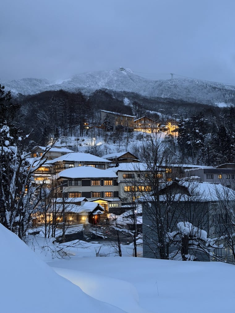
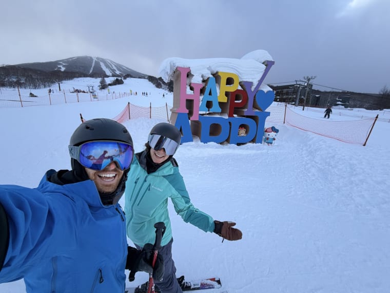
Shizukuishi
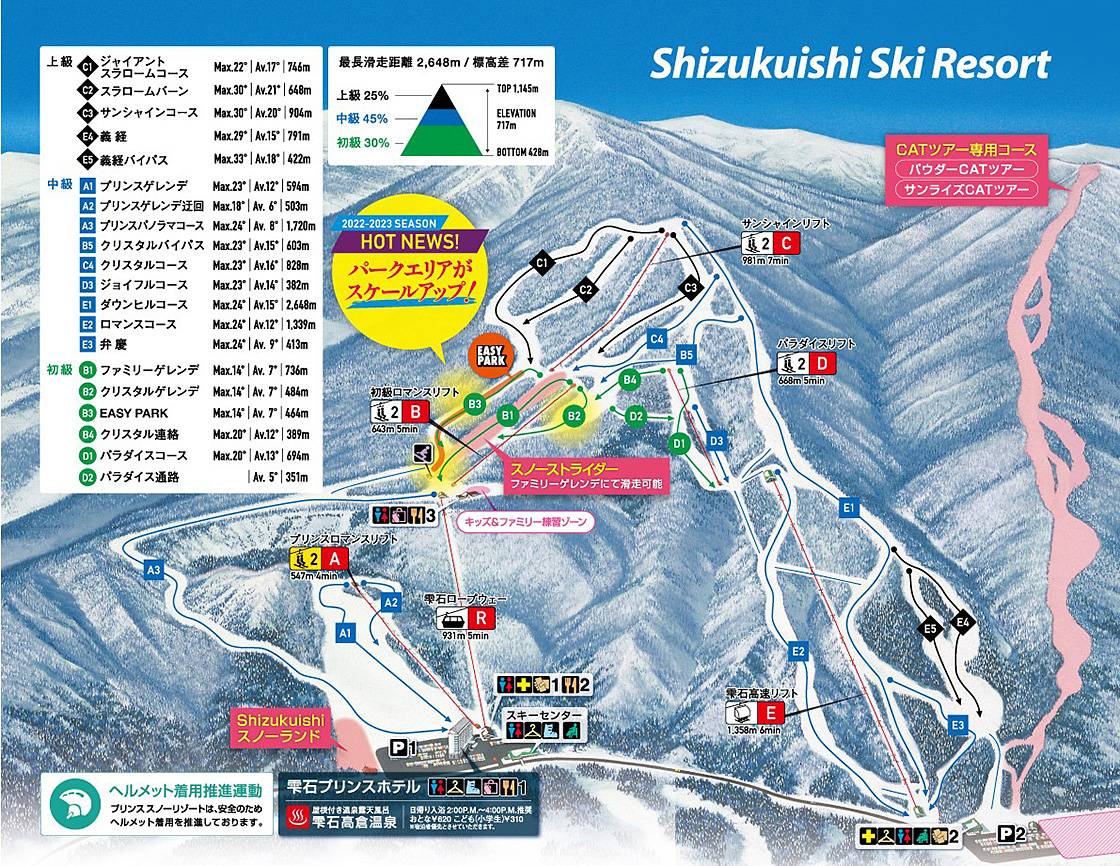
- Prince Hotel group.
- Takakura Outdoor Onsen is beautiful.
- Dramatic views of Mt. Iwate.
Tazawako
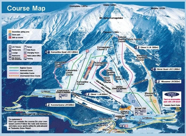
Map kept here for planning. I still need a stronger personal take before writing more.
Geto Kogen
- The king of snow in Tohoku.
- Good target if you are building a Morioka / Kitakami storm-chasing trip.
- I stayed at Geto in 2026 because the resort hotel made the logistics simple.
- Useful guide: Ski Asia Geto Kogen guide
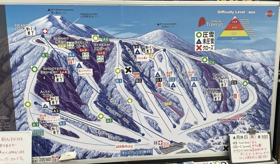
Hakkoda
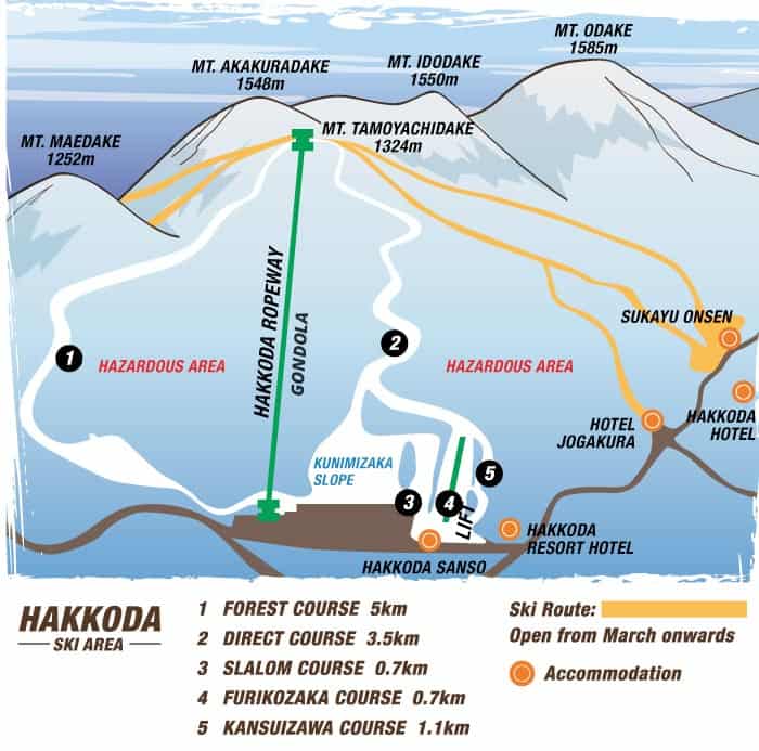
- 45 minutes from Aomori.
- Two lifts: one small double and a 100-person ropeway.
- More lift-accessed backcountry than normal resort.
- Similar category to Asahidake/Kurodake.
- Minimal lodging, no real village.
- You can buy one-way ropeway passes or multi-ride punch cards.
Aomori Springs
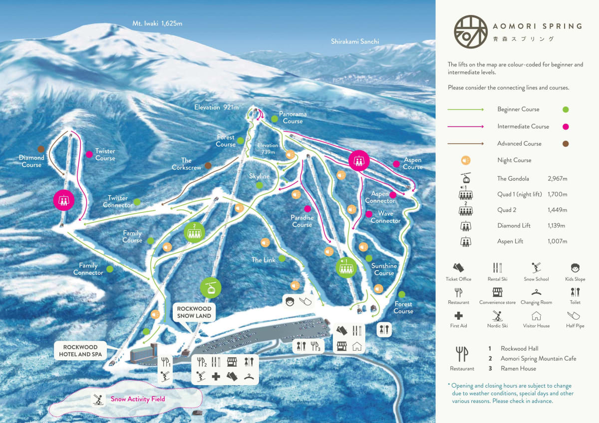
- Fantastic tree skiing.
- Rockwood Hotel is ski-in/ski-out.
- “Advanced” runs are brown because they are intermediate.
- Lift-accessed trees and sidecountry.
- Guiding service available if you want support.
Tohoku Links
- Northern Tohoku Google ski map
- Best ski resorts in Aomori
- 5 best ski resorts in Tohoku
- Whiteroom Tohoku Powder Tour
- Japan Ski Tours Tohoku Storm Chaser
- HME Tohokuyuki
- 7 Days Skiing in Tohoku